A Winter Weather Advisory is in effect for most of western and central Nebraska through mid-week.
A high impact storm system is expected to cross the Central Plains and bring multiple weather impacts Wednesday-Thursday night.
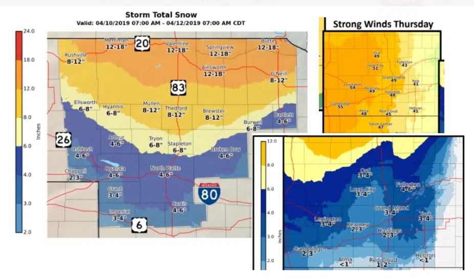
There is increasing potential for accumulating wet snow, strong winds as high as 40-55 MPH, light icing and much colder air.
Highest confidence in heavy snow (6″ or more continues to be from the northern Sandhills to the South Dakota border.
1-2″ of liquid – contingent on Thunderstorms Tuesday night and Wednesday. Severe Thunderstorms possible Wednesday over East and South East Sections of the state.
While this is not the same set up we had a month ago, any rain along recently saturated grounds could cause some isolated flooding concerns.