As projected, the storm track has shifted east changing Garfield and Wheeler counties to be included in the Winter Storm Warning.
The National Weather Service is expecting the rain will transition into snow through Wednesday evening/night and will intensify overnight into Thursday. The snow will taper Thursday night but the winds will continue in areas with blowing/drifting snow into Friday.
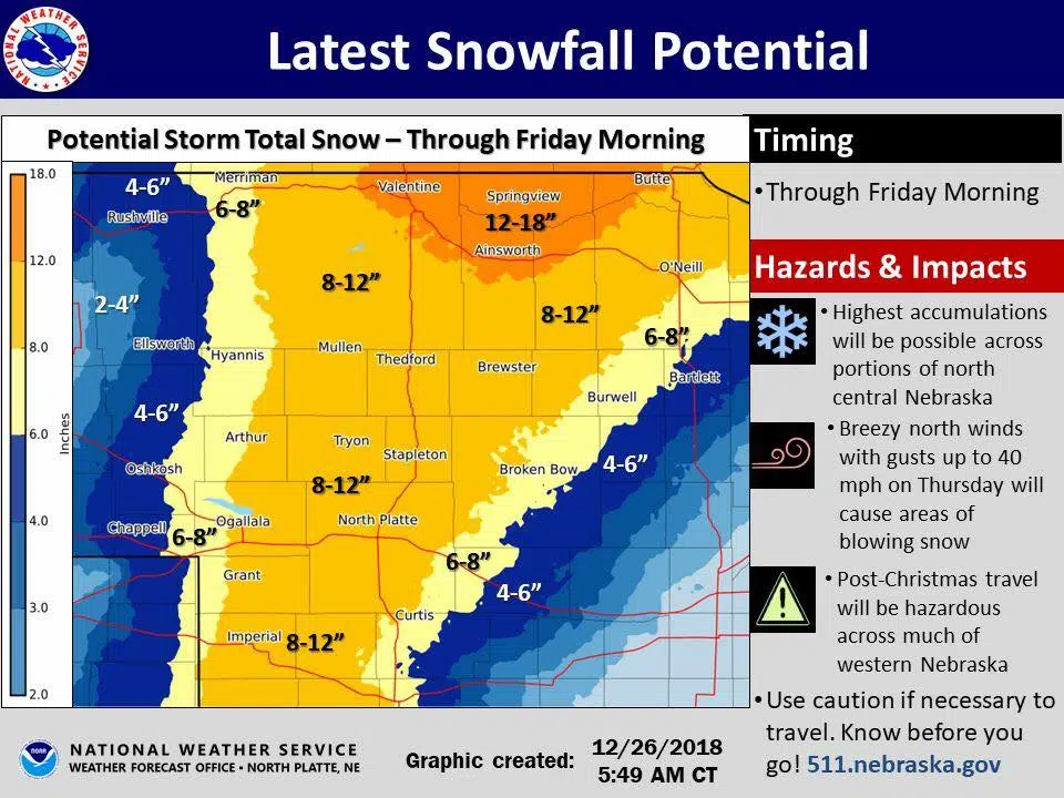
As of right now, the Ainsworth, Valentine and Springview areas are looking at possibly getting 12 inches. That mark goes through the north half of Rock and Brown counties and even into the northwestern edge of Holt County. Majority of Holt County and the bottom half of Rock and Brown counties and all but the southeast edge of Loup county is projecting 8-12 inches of snow. Garfield, Wheeler, and the middles of Custer county are looking at possibly 6-8”. Everything east of that tapers down to 4-6 inches then 2 or less.
The key points of this storm are the wintry mix of rain, freezing rain and snow that will transition into all snow tracking east into Wednesday evening. Some areas could receive 1 inch per hour along the heaviest axis of snow as it intensifies into Thursday. Winds will gust up to 40 mph resulting in blowing and drifting snow. Wind chill values will drop to as low as -10 Friday morning.
Impacts include combination of slick and/or snow-packed roads and greatly reduced visibility resulting in hazardous travel condition.
Stay tuned as we will have more updates coming from National Weather Service as the storm continues.